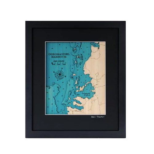


A layered bamboo art map of Lyttelton Harbour, celebrating one of Canterbury’s most distinctive harbour landscapes.
This Matai Gallery small art map captures Lyttelton Harbour, Port Levy, Quail Island and the Christchurch CBD. With its volcanic harbour, surrounding hills, port history and strong connection to Christchurch and Banks Peninsula, this piece celebrates a landscape full of character, movement and memory.
Major roads are marked, adding extra detail and helping connect the harbour landscape to the places, journeys and communities around it.
Carefully constructed by hand, layer by layer, in our Wairarapa workshop, this four-layer bamboo art map brings depth, texture and warmth to a place shaped by harbour, hills, coastline and city connection.
Choose from a black or natural frame to suit your space. Made from layered bamboo ply and framed in FSC pine, each map is carefully finished by hand. Due to the handmade construction and natural materials used, each piece may vary slightly from the image shown, making every map unique.
Details:
- Location: Lyttelton Harbour
- Features: Port Levy, Quail Island and Christchurch CBD
- Size: Small
- Layers: 4
- Frame dimensions: 380mm wide x 300mm high x 28mm deep
- Weight: approx. 1kg
- Frame options: Black or natural
- Major roads marked
- Carefully constructed by hand in our Wairarapa workshop