
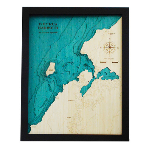
A layered bamboo art map of Porirua Harbour, celebrating the harbour, inlet and island landscapes north of Wellington.
This Matai Gallery medium art map captures Porirua Harbour, Pāuatahanui Inlet and Mana Island. With its sheltered harbour waters, tidal inlet, coastal communities and strong connection to fishing, boating, family homes and local memories, this piece honours a landscape that holds meaning for many in the Wellington region.
The medium format gives the harbour and inlet greater presence, making this a beautiful feature piece for those who live nearby, grew up around Porirua, or feel connected to this distinctive coastal landscape.
Carefully constructed by hand, layer by layer, in our Wairarapa workshop, this six-layer bamboo art map brings depth, texture and warmth to a place shaped by harbour, inlet, island and memory.
Choose from a black or white frame to suit your space. Made from layered bamboo ply and framed in FSC pine, each map is carefully finished by hand. Due to the handmade construction and natural materials used, each piece may vary slightly from the image shown, making every map unique.
Details:
- Location: Porirua Harbour
- Features: Pāuatahanui Inlet and Mana Island
- Size: Medium
- Layers: 6
- Frame dimensions: 42cm wide x 52cm high x 4cm deep
- Weight: approx. 8kg / 8,000g
- Frame options: Black or white
- Carefully constructed by hand in our Wairarapa workshop