
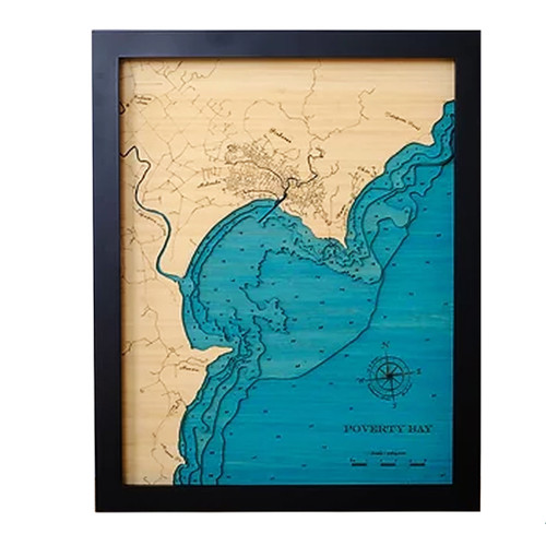
A layered bamboo art map of Gisborne, celebrating Poverty Bay / Tūranganui-a-Kiwa and the surrounding eastern coastline.
This Matai Gallery medium art map captures Poverty Bay / Tūranganui-a-Kiwa and the surrounding seabed, with Gisborne and nearby townships shown in full detail. Makaraka, Wainui, Okitu and Muriwai are all included, along with Mapere Point, Young Nick’s Head / Te Kuri, the Waipaoa River, Tuaheni Point and Tatapouri Point.
With its coastal detail, township layout and seabed contours, this piece celebrates a region strongly connected to first light, surf beaches, family history, fishing, holidays and life on the East Coast.
Carefully constructed by hand, layer by layer, in our Wairarapa workshop, this six-layer bamboo art map brings depth, texture and warmth to a landscape shaped by bay, river, coastline and memory.
Choose from a black or white frame to suit your space. Made from layered bamboo ply and framed in FSC pine, each map is carefully finished by hand. Due to the handmade construction and natural materials used, each piece may vary slightly from the image shown, making every map unique.
Details:
- Location: Gisborne and Poverty Bay / Tūranganui-a-Kiwa
- Features: Makaraka, Wainui, Okitu, Muriwai, Mapere Point, Young Nick’s Head / Te Kuri, Waipaoa River, Tuaheni Point and Tatapouri Point
- Size: Medium
- Layers: 6
- Frame dimensions: 42cm wide x 52cm high x 4cm deep
- Weight: approx. 7kg / 7,000g
- Frame options: Black or white
- Full township detail shown
- Carefully constructed by hand in our Wairarapa workshop